Hey, I don’t either.
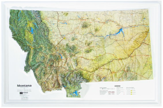
That’s why I’m so thankful I have a Montana raised relief map:
I got that for Christmas because I asked my dad for one.
You can find them on Amazon for about $40.
The maps are 26 inches wide by 17 inches long and an inch deep. It’s that inch of deepness that you want.
What we’re getting at with the “raised” is the mountains having texture. This way you can really see where the Montana mountain passes are.
- What I really like is the flatness of eastern Montana as well. It’s not all flat, however, as you’ll see a mountain here, a butte there, and lots of other interesting features.
- Wow, talk about Montana rivers as well! Montana has 78 rivers and you can see them all on this map.
- Lakes and reservoirs show up nicely as well, and it’s amazing seeing how many are in far flung places in the east, or stuck up in tight mountain spots in the west.
- Seeing all the interstates and highways is helpful, and let’s not forget all the National Forests, Parks, and other monuments that are listed.
- Of course, cities and towns are prominently featured and chances are good you’ll get a better ‘feel’ for where they’re at.
I highly encourage you to get your own Montana raised relief map. I have mine on the wall right by my computer. It makes my Montana writings better, my knowledge of the state more expansive.
Check out the map on Amazon. Isn’t it time to get one for your wall too?
|
|
|


