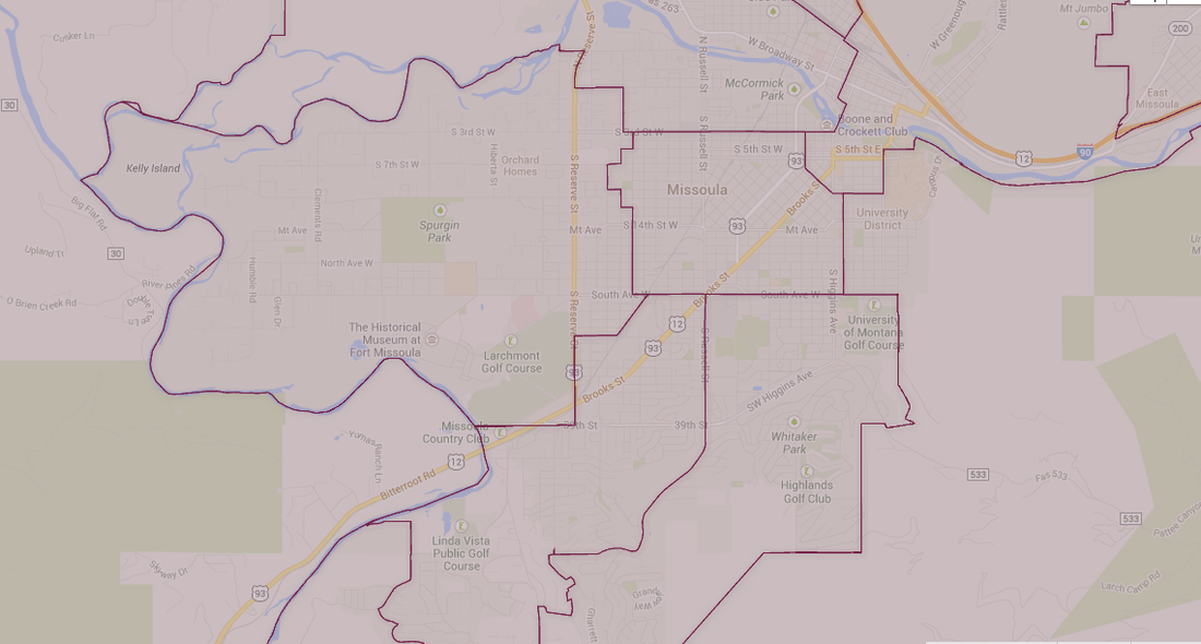

Montana House District 98 is quite the large district.
I have a list of 1,072 voters spread out over this huge area. I need to narrow that down to a more manageable level.
To do that I’m using Google Maps. Here’s how I do that:
I have a list of 1,072 voters spread out over this huge area. I need to narrow that down to a more manageable level.
To do that I’m using Google Maps. Here’s how I do that:
- Print out lists of voters and addresses that I got from the democratic database.
- Pull up Google Maps and figure out which streets are the closest together.
- Print out a map showing those streets and a planned route.
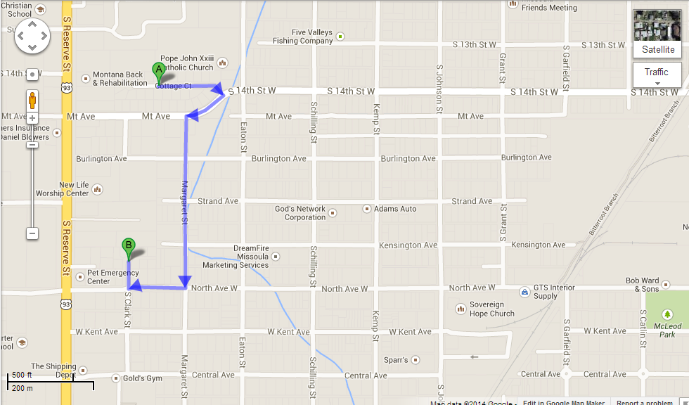
If I were to follow the PDF I'd do street A and then walk all the way down to street B. That's not efficient and I have to map it out myself.
Since I’m still waiting on my bank account to clear I’ve got lots of time to plan out these walking maps. It’s a lot of work – the one PDF file I have is 120 pages.
Right now I have about 50 pages printed out in one area east of Reserve Street. I’ll hit up those houses first and then do the other area later. And of course each of those areas will be divided down further.
If I had more time, money, and volunteers I’d probably print out lists that have a picture of the actual house on there too. I know I’m going to have troubles seeing addresses when I’m out walking in the cold, especially when it’s dark.
As long as I keep track of which houses I’ve visited and which I haven’t I should be alright. And I wonder too how many of those houses my opponent has already hit up.
Yes, lots of work to do.